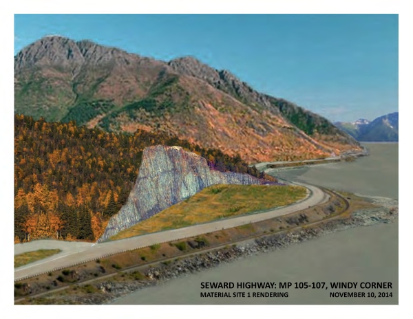
R&M Consultants, Inc. contracted with DOT&PF Central Region to develop ROW mapping for approximately 28 miles of the Seward Highway along Turnagain Arm from Potter Station to Girdwood. The majority landowner along this corridor is the State of Alaska. This includes DNR Parks for the Chugach State Park (CSP), DOT&PF for the Seward Highway ROW and the Alaska Railroad (ARRC) for the railroad ROW. Agreements between the landowners dating back to 1990, 1993 & 2001 recognized the necessary cooperation between the parties that would be required to re-construct and realign the Seward Highway corridor.

Enabling legislation for the CSP and the ARRC prevented disposal of fee title without legislative approval. Legislation was passed in 2000 authorizing transfers of title between the parties for the Seward Highway relocation. My role commenced in 2014 to review the existing land title situation of the parties and to assist in facilitating the necessary land exchange. One would think that a land transaction between three state entities would be far easier than an acquisition of ROW from private parties or federal agencies. Nothing could have been further from the truth. The process has effectively been in play for nearly three decades and to my current knowledge, the result as originally intended has yet to be achieved.
My review of title interests included consideration of whether the Seward Highway ROW was held as an easement or in fee by DOT&PF or whether it had conceivably been terminated all together through the doctrine of "merger of title". The land interest held by the ARRC was reviewed with regard to the status of section line easements (SLE) and the effect of submerged lands within the railroad ROW. The CSP lands were reviewed with regard to the effect of SLEs along with the federal Land & Water Conservation Fund law. An interesting debate was presented by competing AGO Opinions issued by both DOT&PF and DNR AAGs with regard to the status of the Seward Highway ROW through the Chugach State Park.
| Date | Documents |
|---|---|
|
11/26/14 |
IRWA Presentation - Fairbanks |
|
5/27/14 |
|
|
7/30/14 |
Seward Hwy Land Exchange Draft - Report |
|
n/a |
Seward Highway ROW presentation - DOT PowerPoint |
| Land Exchange | |
|
1/13/15 |
|
|
10/14/14 |
|
|
3/30/18 |
|
| Land Exchange - ARRC | |
|
9/10/15 |
|
|
3/12/14 |
|
|
7/20/82 |
|
|
3/16/12 |
|
|
varies |
|
|
n/a |
|
|
6/2005 |
|
|
1/9/85 |
|
|
n/a |
|
|
4/7/89 |
|
|
1916-18 |
|
| Land Exchange - ARRC - ARRC/DOT | |
|
8/31/98 |
|
|
6/8/13 |
|
|
n/a |
|
|
3/7/14 |
|
| Land Exchange - ARRC - BLM | |
|
3/23/04 |
|
|
3/17/06 |
|
|
3/23/04 |
|
|
4/2/88 |
|
|
4/4/88 |
|
| Land Exchange - ARRC - Reversion | |
|
5/1898 |
30 Stat 409 - Railroad ROW in Alaska |
|
5/8/06 |
|
|
n/a |
CRNWRR
Reversion Issue - Copper River Railroad |
|
5/7/12 |
|
|
n/a |
|
|
varies |
Pages from Misc Correspondence Field Comm PLO 47 Act BLM etc |
|
varies |
railroad packet complete Part1 - The Alaska Railroad Easement |
|
varies |
|
| Land Exchange - ARRC - State Lands | |
|
1/22/14 |
|
|
12/1/00 |
|
| Land Exchange - ARRC - Submerged Lands | |
|
3/20/70 |
|
|
1/26/71 |
|
|
3/31/92 |
|
|
6/15/11 |
|
|
3/24/17 |
|
|
3/29/17 |
|
|
6/3/88 |
|
|
n/a |
|
|
1/2000 |
|
|
6/19/97 |
United States v. Alaska - Submerged Lands |
|
6/8/87 |
|
| Land Exchange - DOT | |
|
12/23/13 |
|
|
12/26/12 |
|
|
n/a |
|
|
2/24/14 |
|
| 12/13/02 |
|
|
10/8/04 |
|
|
8/5/69 |
|
|
9/2013 |
|
|
8/30/11 |
|
|
12/21/99 |
|
|
varies |
|
| Land Exchange - DOT - Sample Exch Docs - ARRC to DOT | |
|
2/18/14 |
|
|
1/28/11 |
|
| Land Exchange - DOT - Sample Exchange Docs - DOT to ARRC | |
|
1/28/11 |
|
|
4/2/14 |
|
| Land Exchange - DOT - \Sample Exchange Docs - DOT to DNR | |
|
2014 |
|
|
4/2/14 |
|
|
n/a |
|
| Land Exchange - MOU/MOA | |
|
10/7/90 |
|
|
8/26/93 |
|
|
8/26/93 |
|
|
10/16/01 |
|
|
10/16/01 |
|
|
8/10/90 |
|
|
10/2001 |
|
| 6/28/07 |
|
|
3/13/17 |
|
| Land Exchange - Parks | |
|
12/2/14 |
|
|
10/8/04 |
|
|
3/6/13 |
|
|
5/2011 |
|
|
n/a |
|
|
5/2011 |
|
|
n/a |
|
|
3/2013 |
|
|
5/10/02 |
|
|
12/4/14 |
|
| Land Exchange - Parks - LWCF | |
|
1/15/15 |
|
|
1/28/02 |
|
|
10/1/08 |
|
|
2007 |
|
|
varies |
|
|
10/1/08 |
|
|
n/a |
|
|
n/a |
|
|
2/1/14 |
|
|
3/4/15 |
|
|
n/a |
|
|
2007 |
|
|
n/a |
|
|
n/a |
|
|
n/a |
|
| Legal | |
|
2000 |
|
|
n/a |
|
|
3/21/14 |
HB 371 - DOT Proposed Bill |
|
10/11/13 |
|
| Legal - AGO | |
|
12/12/14 |
|
| 3/27/64 |
|
| 10/29/85 |
|
|
7/8/15 |
|
|
1951 |
|
|
1959 |
|
|
n/a |
|
|
8/2014 |
|
|
varies |
|
| Legal - AGO - DNR ROW Response | |
|
10/28/15 |
|
|
7/28/82 |
|
| Legal - AGO - DOT ROW Memo | |
|
1/6/81 |
|
|
12/15/86 |
|
|
12/20/01 |
|
|
2/2/88 |
|
|
4/8/85 |
|
|
6/1/15 |
|
|
7/28/82 |
|
|
n/a |
|
|
varies |
|
|
varies |
|
|
varies |
|
|
varies |
|
| varies |
|
|
7/8/15 |
|
|
4/23/91 |
|
|
4/7/58 |
|
|
4/7/58 |
|
|
8/8/83 |
|
|
8/1/56 |
|
|
varies |
|
|
3/3/00 |
|
|
1/2003 |
|
| Legal - Ch.116 SLA 2000 | |
|
2000 |
|
|
4/29/00 |
|
|
11/19/14 |
|
|
4/28/00 |
|
|
3/2/00 |
|
|
7/14/00 |
|
|
4/28/00 |
|
| Legal - HB274 2016 | |
|
1/22/16 |
|
|
1/22/16 |
|
|
1/22/16 |
|
|
1/27/16 |
|
|
8/2012 |
HB 274 Supporting Documents-Parks Div Briefing on Point Bridget |
|
12/2008 |
|
|
1/26/16 |
|
|
2/5/16 |
|
| Legal - Merger of Title | |
|
12/11/14 |
|
|
12/15/96 |
|
|
6/13/96 |
|
|
7/9/09 |
|
|
9/18/92 |
|
|
n/a |
|
|
n/a |
|
|
3/10/09 |
|
| Legal - SLE | |
|
1/5/99 |
|
|
11/6/63 |
|
|
12/18/69 |
|
|
12/19/96 |
|
|
12/23/14 |
|
|
12/6/13 |
|
|
2/12/10 |
|
|
2/2009 |
|
|
4/11/11 |
|
|
7/15/14 |
|
|
9/16/14 |
|
|
n/a |
|
| n/a |
Comments by other than the General Public - Easements Regulations |
|
7/2001 |
|
|
n/a |
|
|
n/a |
|
| R&M Seward Highway Mapping | |
|
n/a |
|
|
n/a |
|
|
n/a |
|
|
n/a |
|
|
n/a |
|
|
n/a |
|
|
n/a |
|
|
n/a |
|
|
n/a |
|
|
n/a |
|
|
n/a |
|
| 7/30/14 |
|
| 7/30/14 |
|
|
n/a |
|
|
n/a |
|
|
n/a |
|
| Mapping - BLM Township Plats |
|
|
1/26/00 |
|
|
11/5/96 |
|
|
1/26/00 |
|
|
4/15/57 |
|
|
10/28/54 |
|